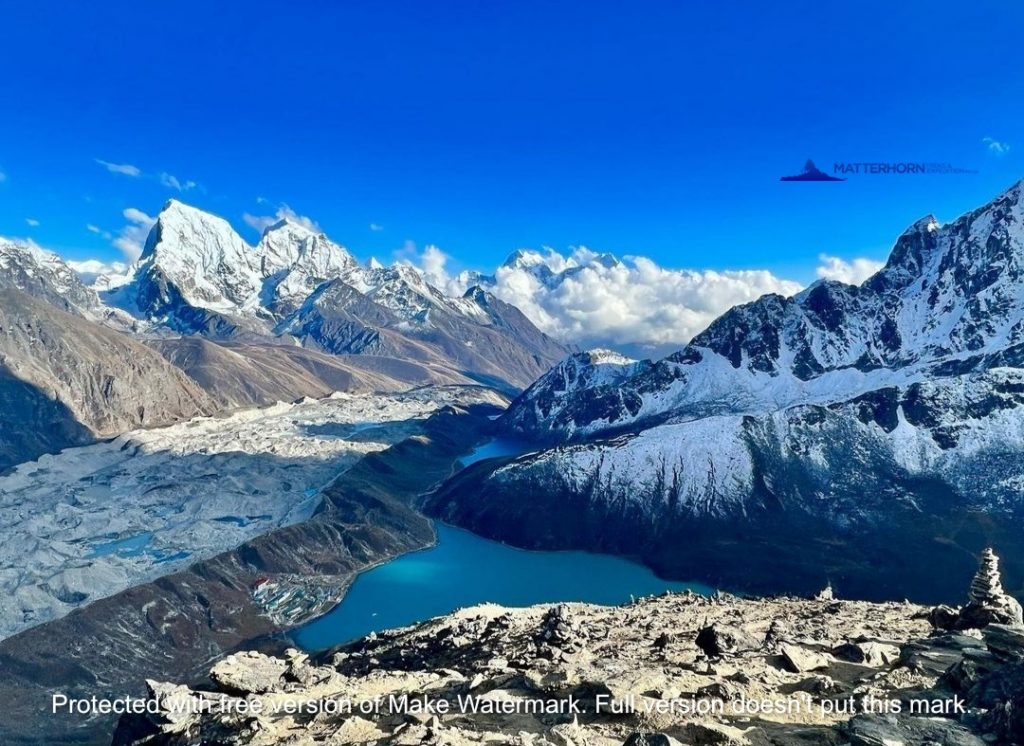
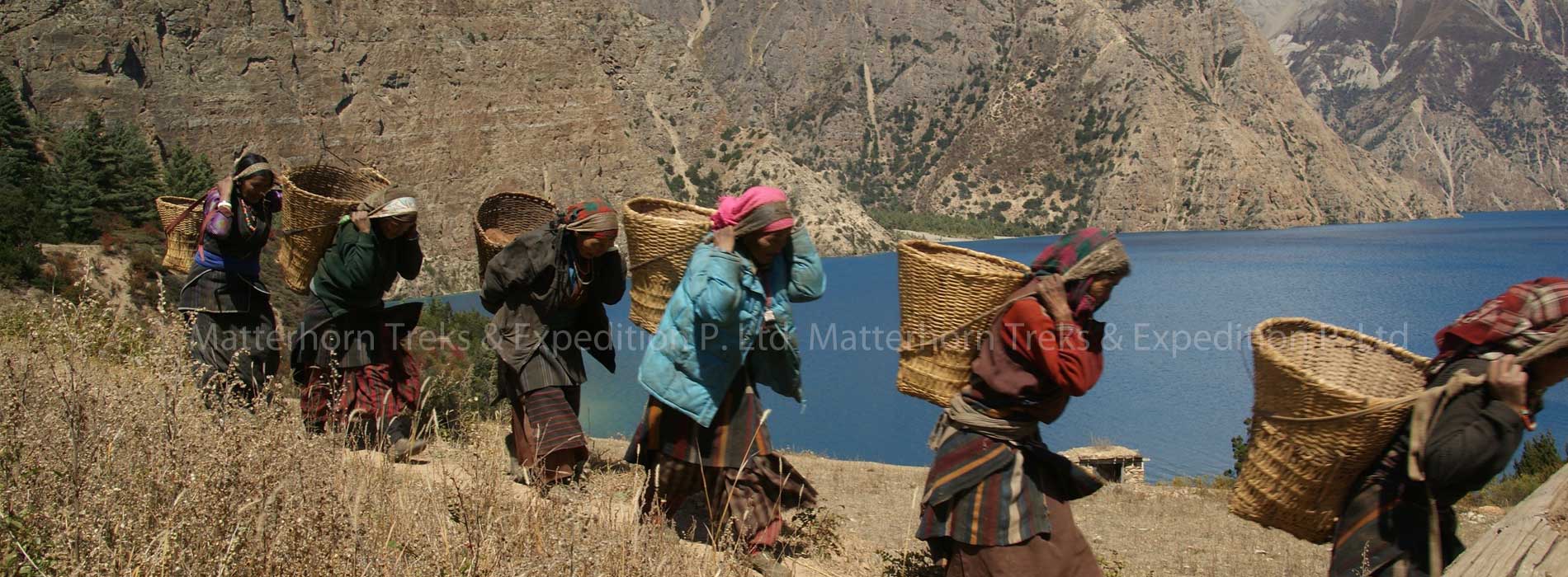
Dolpa which is also called “Ba Yul” or the hidden valley is a land of mystery, scenery and peace and is surrounded by Dhaulagiri and Tibet from South and North. The Dolpo region is the natural embodiment of high passes, rare flora and fauna and sweeping vistas. All the trekking areas in this region stretch through and around Arun River whose origin dates back to the prehistoric period. The Dolpo region was opened for the foreigners since 1990. The Dolpo region is located inside the Shey-Phoksundo National Park in mid-western Nepal, behind the Dhaulagiri massif, towards the Tibetan plateau. The region offers opportunities to visit ancient villages, high passes, beautiful Lakes, isolated Buddhist monasteries and also to experience the vast array of wildlife inhabiting the region, including Blue sheep, Mountain Goat, Jackal, Wolf and the legendary Snow Leopard. This remains a truly isolated corner of Nepal, time has stood still here for centuries as inhabitants of Tibetan stock continue to live, cultivate and trade. Most treks into Dolpo take from 14 to 30 days. The best time to trek here is towards the end of the monsoon season Sept to November. Shorter Dolpo treks are possible by flying into the air strip at Jumla. In the far reaches of Northwestern Nepal lies the extreme landscape of Lower Dolpo. The route begins by meandering through pine and cedar forest with views of the massive Dhaualgiri range in the background. The entrance to Dolpo lies beyond the Jangla Bhanjyang Pass, (4500m). At the head of the valley lay snow-capped peaks and the desolate Tibetan plateau beyond. Protected from rain, this region is dry where the Dolpo inhabitants have carved out a niche of survival in the harsh surroundings by trading with nearby Tibet. A vision of beauty, the Phokshindo (Ringmo) and the legendary monastery of the pre-Buddhist Bonpo sect is our momentous destination. As the most remote and least developed district in Nepal, this trek is reserved for those with a true sense of adventure.
Day 02: Arrive in Kathmandu (1300m)
Arrival in Kathmandu Tribhuvan International Airport, a representative from Matterhorn Treks & Expedition will transfer to your hotel, We will briefed about your trip activities. You’ll have rest of the day at leisure. Overnight at Hotel.
Day 03: Kathmandu (1300 m)
Sightseeing in Some of landmarks that are the World Heritage Sites of Kathmandu Durbar Square, the sacred Hindu temple of Pashupati Nath, the famous ‘Monkey Temple’ (Swayambhu Nath) and Buddhists shrine (Bouddha Nath. You can also make your last minute buying of personal items and preparation for the next day. Overnight at Hotel.
Day 04: Flight Kathmandu – Nepalgunj
To get to Dolpa, generally you have to fly to Nepalgunj first. Nepalgunj is a steaming hot city in South Western Nepal, in the lowlands of Terai, close to the Indian border, which is just 8 km away. Culturally the areas more resemble India than upland Nepal. Take a cycle rikshaw for a ride in town. You pass the hustle and bustle of the bazaar and see horse carts full of colorful people going to or coming from the Indian border. The Bageshowri temple is one of Nepal’s most important Hindu temples and is worth a visit as well. Overnight at Hotel.
Day 05: Nepalgunj to Jumla
An early morning plane will take us to the town of Jumla, which lies on the banks of the Tila Khola river at 2370 meter. Jumla is one of the highest rice-growing areas of the world, where the unique ‘red’-rice is grown. Overnight at Camping.
Day 06: Trek Jumla to Gothi Chaur (2650m)
From Jumla our trail leads past several water-driven mills before dropping to the confluence of the Tila Khola and the Chaudhabise Khola. From here our trail climbs gently alongside rice terraces to the village of Dochal Ghara at 2530 meter. From here we follow the trail through a forest of maples and walnuts to a meadow. In season the wildflowers seen here include cinquefoils, terrestrial orchids, forget-me-nots, mints, buttercups, primulas, edelweiss and gentians. Beyond the meadow the trail climbs to a rocky cairn at Pattyata Lagna (2830m), and then descends into a magnificent alpine amphitheatre towards Gothi Chaur close to the stream at the bottom of the valley. At the spring here there are some 13th century Malla dynasty stone carvings. Overnight at Camping.
Day 07: Trek Gothi Chaur to Naphukana (3080m)
After ascending through fields of barley and buckwheat we arrive at the trail junction at Muni Sangu, a small settlement where we can see peculiar carved wooden faces, called dok-pa and are supposed to offer protection from evil spirits. These faces can be seen throughout the whole Dolpo region. We stay on the southern side of the river from here as the valley slowly becomes narrower and follow our way to Changrikot (a series of houses built into the hillside on the opposite side of the river at 2900m). The trail then finally crosses the river and climbs towards the grey stone houses of Chotra (3010m). The village has typical mani walls (walls containing stones carved with Tibetan Buddhist prayers) and a kani (arch, decorated with paintings on the inside) over the trail. A short distance from here is the Tibetan settlement of Naphukana where we will make our camp for today. Overnight at Camping.
Day 08: Trek Naphukana to Chaurikot (3060m).
The trail becomes steeper today and climbs through a forest to a pass named Mauri Lagna (3820m). From the pass there are views of snowy peaks to the north and east. Descending from the pass, the trail traverses a steep slope before dropping into a forest of pine and oaks. We then enter the Bheri Valley and after following the trail in and out of side valleys, we arrive to the village of Chaurikot. Overnight at Camping.
Day 09: Trek Chaurikot to Bheri River (2610m).
Continuing on to the village of Balasa we can see Kagmara peak on the horizon. The trail drops to a stream before climbing through a forest of walnut trees to a ridge. Passing through the apple orchards of Jyakot, we then descend to the village of Rimi before following a rocky trail down to the Bheri River. Overnight at Camping.
Day 10: Trek Bheri River to Garpung Khola (2900m).
We stay on the west bank of the Bheri River, passing Hurikot and arrive at the entrance to the Shey Phoksundo National Park. We then come to the confluence of the Garpung and Jagdula Rivers, which joins the Bheri River. Overnight at Camping.
Day 11: Trek Garpung Khola to Kagmara (3500m).
We continue to follow the Garpung Khola, ascending slowly towards the Kagmara La. Today is a short trek but it is very good for acclimatization that we don’t ascend too quickly. Overnight at Camping.
Day 12: Trek Kagmara to Kagmara Phedi (4000m).
Today we cross to the eastern side of the river, where the valley narrows and the river becomes a series of waterfalls. Overnight at Camping.
Day 13: Trek Kagmara Phedi to Pungmo Khola.
Today we need to start early morning and ascend alongside the Kagmara Glacier to the Kagmara La (5115m). This is a good place to spot the rare blue sheep. After a 900m descent, we reach the pastures of the Pungmo Khola Valley. Overnight at Camping.
Day 14: Trek Pungmo Khola to Pungmo Village.
Our trail enters the birch and juniper forests which soon give way to blue pine. Up the side valleys, there are views of Kanjirolba peak before we reach the fortress-like village of Pungmo, set amidst barley fields. Overnight at Camping.
Day 15: Trek Pungmo Village to Phoksundo Lake.
We climb through a forest of large cedars to the winter settlement of Palam and continue ascending through the open country to a ridge from which there are good views of the lake in the distance. Close by is a spectacular waterfall, the highest waterfall in Nepal. After crossing a bridge below Ringmo, the trail continues northwards to the shores of Phoksundo Lake. Overnight at Camping.
Day 16: Trek Phoksundo Lake to Chhepka.
We back track our path to Ringmo village and continue past Palam to the Suli Gaad valley, following the stream originating from the Phoksumdo Lake. After a descent of almost 900 meters we will arrive in the small village of Renje, which consists of 9 houses on the side of the river. From there we continue trek to Chhepka this day is one of the longest day on this trip, after long day we arrived in our campsite. Overnight at Camping.
Day 17: Trek Chhepka to Dunai.
Today we pass through the villages of Ankhe, Rahagaon and Parela, meaning ‘eye’ ‘eyebrow’ and ‘eyelash’ respectively. We keep walking downstream following the river to Dunai. Overnight at Camping
Day 18: Trek Dunai to Juphal (2354M) 3 hours
Today we walk to the region famous for its lotus-like plant called chuk, which is used to make vinegar and medicines. We pass through the villages of Ankhe, Rahagaon and Parela, meaning ‘eye’, ‘eyebrow’ and ‘eyelash’ respectively. We keep walking downstream following the river to Dunai. From here we ascend to Juphal climbing through wide meadows. In Juphal we will spend the night in one of it’s hotels where a well deserved hot shower awaits us. Overnight at Camping or Lodge.
Day 19: Fly to Kathmandu via Nepalganj
Early morning flight to Nepalganj. Today we need good weather to complete the two flights and
This is a wonderful 35-minute flight over the Himalayan foothills, with fine views of the main peaks including Annapurna and Dhaulagiri to the north. You then connect with the flight back to Kathmandu. Overnight at Hotel.
Day 20: Kathmandu
This pleasant day you may have full day at leisure at your own or can be extends your extra trip with us on additional cost or time to explore the Thamel for last day shopping and evening Matterhorn Treks & Expedition will take you for Farewell dinner at Typical Nepali Restaurant. Overnight at Hotel.
Day 21. Departure from Kathmandu. Matterhorn treks & Expedition will transfer you to the International Airport for your departure flight to your own destination
Fill up the form below to tell us what you're looking for