Mount Kanchenjunga, the third highest peak in the world lies on the eastern border of Nepal and India. The trek provides you with the chance to experience the remoteness of this region, romantic mountain views, diverse flora and fauna and rich local culture. This trek is considered a non-technical trek. If you are moderately fit and have a sense of adventure you will enjoy this trek. The program is designed to acclimatize you gradually and so avoid high altitude sickness. However you are requested to check your fitness. We suggest you to strengthen your knee muscles and prepare for several days of steep descents. Physical fitness programs such as running, swimming, biking or aerobics are recommended, but mostly hiking on steep hills or running up and down steps are preferable. Please note that the following program can change under certain circumstances and adjustments may have to be made during the trekking. We ask you to be flexible and accept any changes happily.
The trek is a camping trip, everything is handled by our team of porters, sherpas and cooks who carry the equipment, assemble and dissemble the camp and have hot meals waiting for you at every food break.
Day 01 Arrival in Kathmandu
Arrival in Kathmandu Tribhuvan International Airport, a representative from Matterhorn Treks & Expedition will transfer to your hotel, We will brief about your trip activities. You’ll have rest of the day at leisure.
Overnight at Hotel B/B.
Day 02 Kathmandu Sightseeing
Sightseeing in Some of landmarks that are the World Heritage Sites of Kathmandu Durbar Square, the sacred Hindu temple of (Pashupati Nath), the famous ‘Monkey Temple’ (Swayambhu Nath) and Buddhists shrine (Bouddha Nath). You can also make your last minute buying of personal items and preparation for the next day.
Overnight at Hotel B/B.
Day 03 Kathmandu-Biratnagar
Flight to Biratnagar takes 45 minutes from Kathmandu.
Overnight in Hotel in Biratnagar.
Day 04 Biratnagar/Suketar/Lalikharka
To avoid clouds and wind, Suketar flights operate early in the morning, so you can probably accomplish a few hours of walking in the day you fly in the Airport is on the top of ridge in SUKETAR village, far above Taplejung. From SUKETAR, elevation 2300 meters, the trail climbs gradually along a rhododendron covered ridge. The trail crosses the ridge and contours past the Deorali River and four more streams to a pass at 2570 meters. Descend through forests to LALIKHARKA. Walk approximately 4 hours.
Day 05 Lalikharka/Shikaicha Bhanjyang (2050 m), 6-7 hrs
Trek through fields to the substantial Lumbu village of THEMBEWA AT 1880 METRES. From Thembewa, the trail ascends a bit to a ridge, and then drops steeply through Shimu and Pokhara villages to a suspension bridge across the Phawa River at 1430 meters. There is a good swimming hole here and a possible campsite near the river. Climb steeply to Khunjari, a Limbu village at 1700 meters. Turn left just beyond the school and climb through wheat fields to a sadly.
Day 06 SHIKAICHA/MAMAMKHE (1810 m), 6-7 HRS
The trek has now entered the Kabeli river valley, but you will spend the next two days climbing up and down, in and out of ravines and over ridges, only to end up in Yamphudin at the bottom of the valley. Turn left from Bhanjyang and head north just below the top of the ridge, descending to the scattered village of Keswa at 1960 m. Pass below waterfalls and cross several streams and landslide to reach the village of Phun Phun, which is shown on some maps with the fanciful spelling fun. Descend steeply through rice terraces into a side canyon, crossing a stream on a long suspension bridge at 1540 meters, then climb back to Mamanke, a prosperous Limbu village.
Day 07 MAMANKHE/YAMPHUDIN (1690 m), 6-7 HRS
Climb to a ridge and then descend gradually to the Tenguwa River. Forgo the decrepit bridge; cross the stream by jumping from stone to stone. Switch back steeply up to another ridge marked by a Chorten and prayer flags, and then descend across rubble and rock slides and cross another stream. This portion of the valley is steep, and portions of the trail are on cliffs high above the river as it makes its way down to the Kabeli River at 1640 meters. Stay on the west side of the Kabeli River, climbing gently to yamphudin at the junction of the Omje River and the Kabeli River. Yamphudin is a massed community of Sherpas, Lumbus, Rais and Gurungs. Among the corn and rice fields of the village there is a police post, a school, and some shops with minimal supplies.
Day 08 YAMPHUDIN/TORONTAN (2990 m), 7-8 HRS
Cross the Omje River on a couple of bamboo poles and follow the Kabeli River upstream for a short distance, ignoring the suspension bridge. After you pass behind a ridge out of sight Yamphudin, cross a small stream and take a trail that heads straight uphill. Zigzag up through fields of corn and barley to Darachuk, and keep climbing past meadows to Dubi Bhanjhyang, a pass at 2540 meters. Cross the stream on a log bridge, and go a bit further upstream to Omje River. Trek all the way passing through the villages of Chitre (2920 m) lamite Bhanjyang (3410 m) then the trail emerges into the open just above the Simbua River. A 1987 flood washed away large parts of the trail. Stay above the white salty river and follow it upstream, on a series of ascents and descents, to temporary bridge built of stones and logs.
Day 09 TORONTAN/TSERAM (3870 m), 5-6 HRS
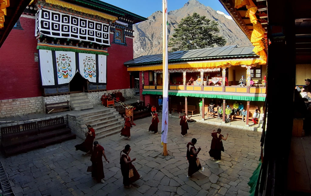
The hike starts in forests of several varieties of rhododendron, and then crosses landslides to Tsento Kang, a Goth at 3360 meters. The deeply forested valley is dotted with clearings, meadows and streams as it rises to another Goth at Watha. An hour beyond is Buddhist shrine decorated with rock cairns, prayer flags and iron, three-pronged Trisuls. The shrine is in a cave that has a streak of dark stone slang it, which is tough to be the image of a snake. This shrine marks the boundary of a sacred part of the valley, beyond which the killing of animals is prohibited.
Day 10 TSERAM/RAMCHE (4620 m), 6-7 HRS
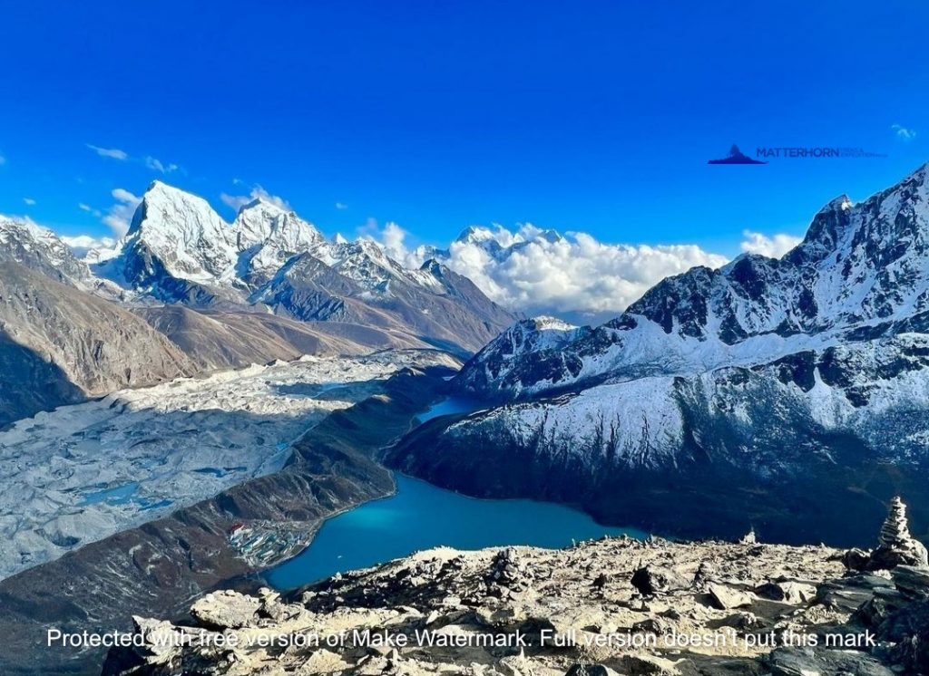
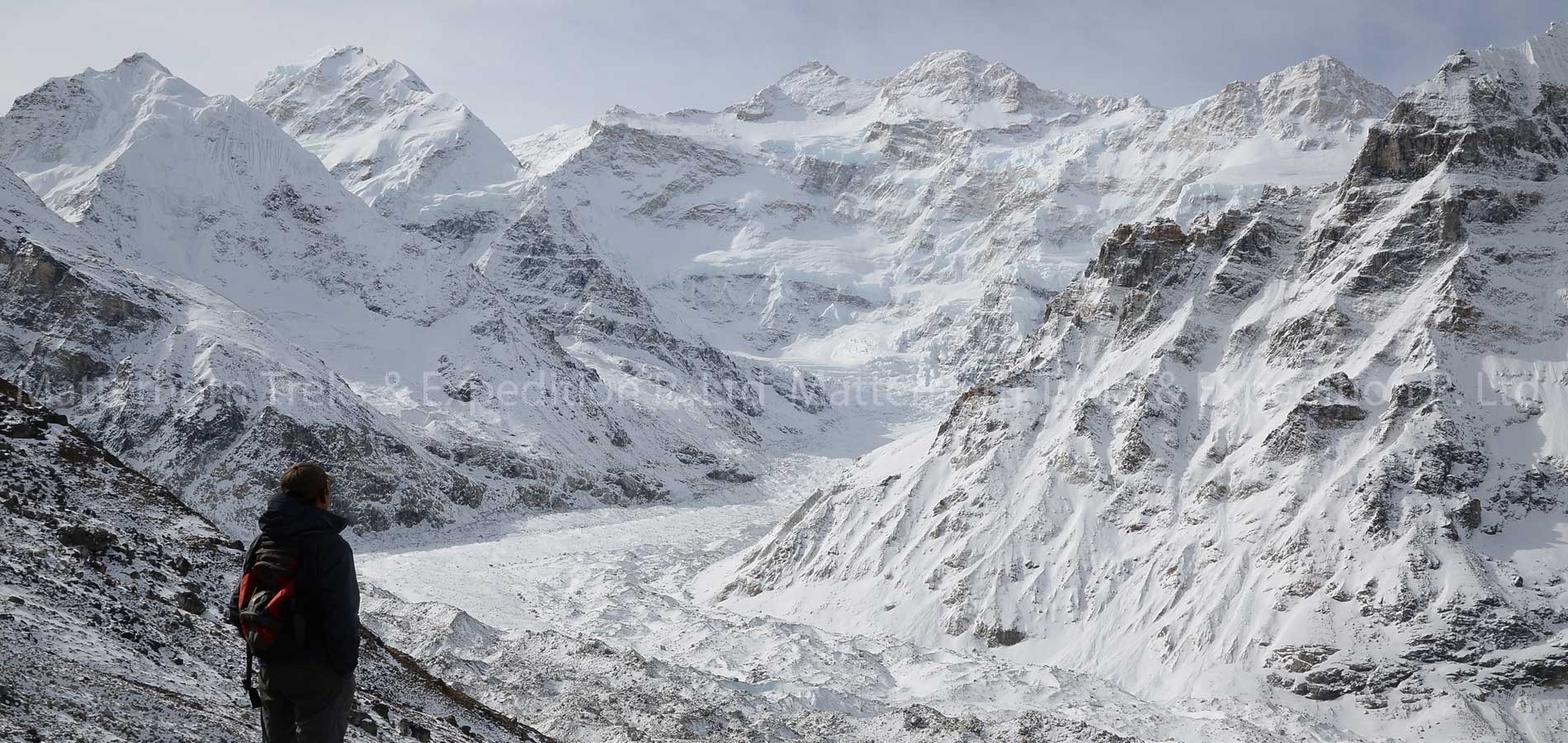
Climb through forests to a slide area; the junction of the trail to Mirgin La is nearby, but trail is hard to find. Stumble across a stream on a loose, rocky path and climb to some main walls and a stone house near the tree line at 4040 meters.The valley opens up as you approach Yalung, a pasture full of Yaks at 4260 meters. Climb alongside the moraine through scrub junipers up a stream to a lake at Lapsan 4430 meters. The view is dominated by the spectacular Rathong peak, elevation 678 meters, situated on the Nepal-India border to the east.
Day 11 RAMCHE/OKTANG (4800 m), 6-7 HRS
Day 12 OKTANG/RAMCHE (4620 m) 6½ HRS Same way back to Ramche
Day 13 RAMCHE/TSERAM (3870 m), 7½ HRS
Day 14 TSERAM/GHUNSA (3440 m), 6-7 HRS
Today, the trail ascent steeply 1000 meters from Simbua river valley and cross five passes i.e., unnamed pass of 4724 meters, Mirgin La 4663 m, Sinion La 4660 m, an unnamed 4115 m. an a final Tamo La 3900 m. The route enters the Gunsa Village at 3440 m. Gunsa is slowly developing into a trekking village and has a few shops and lodges. The police check-post in Gunsa takes itself very seriously.
Day 15 Rest day at Ghunsa
Day 16 GHUNSA/KYAPRA (2730 m), 6-7 HRS
The valley widens as you trek through fields and larch forests to a Tibetan village PHERA with pleasant Gompas and friendly monks; you may find a better supply of food, especially potatoes. Follow along the river through a fir and rhododendron forest into a side ravine then ascend steeply towards Kyapra, called Chapla or Gaabla by the Tibetan inhabitants.
Day 17 KYAPRA/GHAIYA BARI (2530 m), 7-8 HRS
From here, climb steeply down to a large waterfall in the Gunsa river. The trail makes many short climb and descents and passes several waterfalls and pastures. Trek into lush bamboo, oak rhododendron forests with views of Nango Ma and the south-west part of the Kanchenjunga Massif. Descend for 100 meters, to the Tibetan settlement of Amjilassa at 2490 meters.
Day 18 GHAIYA BARI/CHIRWA (1190 m), 7-8 HRS
The trail makes more ups & downs, traverses a landslide, crosses the Tamua River on a suspension bridge above the village of Helok. There is a teashop near the junction where the trail to the Limbu village of Helok leaves the main Tamur Kosi route. There is a bridge across the Tamur that leads to the Chhetri village of Tapethon and continue to the Chirwa, a pleasant bazaar with a few shops at 1190 meters.
Day 19 CHIRWA/Suketar(1480 m), 6-7 HRS
Day 20 Flight to Kathmandu via Biratnagar
Overnight at Hotel B/B.
Day 21 Kathmandu
This pleasant day you may have full day at leisure at your own or can be extends your extra trip with us on additional cost or time to explore the Thamel for last day shopping and evening Matterhorn Treks & Expedition will take you for Farewell dinner.
Overnight at Hotel B/B.
Day 22 Departure from Kathmandu
Matterhorn treks & Expedition will transferred to the International Airport your departure flight to your on wards destination.
Fill up the form below to tell us what you're looking for