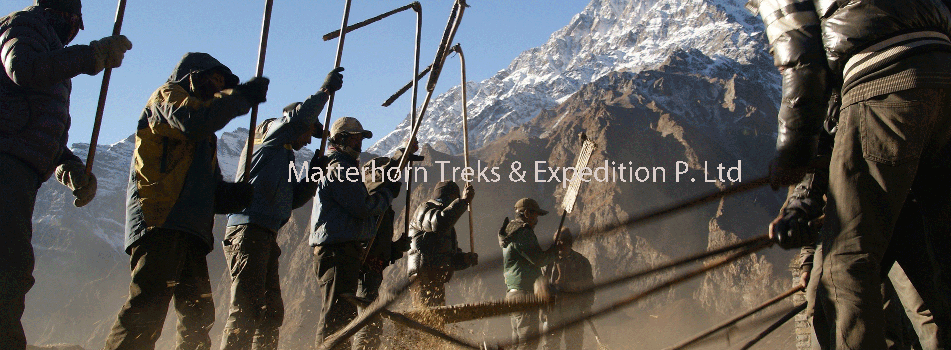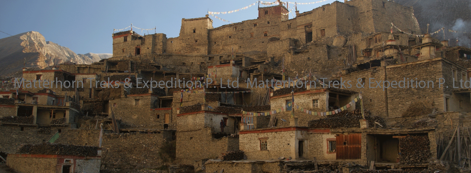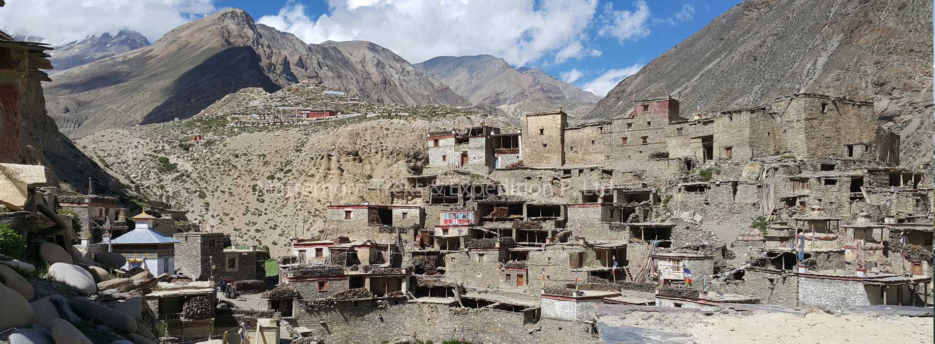


Hidden by swirls of mountain mist ahead of us, from Kangla pass at 5200m the magnificent panorama view of Annapurna massif appears remote and forbidding. Our sturdy mountain ponies every few steps, their steaming sweat-soaked bodies heaving. Behind us Hongde airport, which we left behind early in the morning, is a tiny speck. Our destination is the Nar-Phu valley, above the tree line on the upper limits of cultivation, in the very north of Manang district. It takes five hours reaching the pass that links Nar with Manang and three other Bhotia villages in the Nyershang down valley. Nowadays, Nar Phu the population about 300 inhabitants who depend on livestock, unlike most Bhotia people, whose trading patterns changed drastically after the Nepali Government closed borders with Tibet, the people of Nar and Phu valley were least affected by this change. The tortuous path leading from the valley into Tibet had never made them dependent on the salt trade, and till today yak herding is the basis of their livelihood. Besides the Kangla linking Nar to the Nyeshang valley, the most direct route from Kathmandu to Nar and Phu is along the Marshyangdi River.
Travellers trek through the Himalayan foothills and round the eastern end of the Annapurna before they arrive at Qupar, a police check post half an hour before Chame, Manang’s district headquarters. From here a long and steep trail winds up to Nar and Phu whose villagers, laden with goods purchased in Chame and even lower down in Besishhar, the end of the roadhead leading to Manang, often camp at Dharmashala, a rudimentary wooden hut built by the people from the two villages. The Nepal government’s recent decision to open up Nar and Phu to tourists has evoked little enthusiasm among the villagers, whose pastoral lifestyle continues. Apart from the odd researcher and climbing expeditions permitted to climb Him lung, Ratnachuli and Gachikang, few foreigners has visited the area and tourism infrastructure is almost non-existent. Since Annapurna Conservation Area Project (ACAP) recently extended its network to include Nar and Phu Valley, it is preparing a suitable tourism development plan at the request of the government for undiscovered valley.
Day 01: Arrival day in Kathmandu (1,300 m)
Arrival in Kathmandu Tribhuvan International Airport, a representative from Matterhorn Treks & Expedition will transfer to your hotel; we will brief about your trip activities. You’ll have rest of the day at leisure.
Overnight at Hotel B/B.
Day 02: KTM Sightseeing Tour & Preparation
Sightseeing in some of landmarks that are the World Heritage Sites of Kathmandu Durbar Square, the sacred Hindu temple of (Pashupati Nath), the famous ‘Monkey Temple’ (Swayambhu Nath) and Buddhists shrine (Bouddha Nath). You can also make your last minute buying of personal items and preparation for the next day.
Overnight at Hotel B/B.
Day 03: Drive to Bhulbhule (830 m) by bus, 8 hours
After breakfast we drive 6-7 hrs by private transport to Bhulbhule through the scenic countryside and river view. This is an interesting drive through the foothills of the Himalaya. En-route to Pokhara our route diverts from the town village of Dumre towards north to Beshishahar. This is big town and district headquarters of the Lamjung.
Overnight at the Lodge on Full board.
Day 04: Drive from Bhulbule to Koto (2600m) 4/5 hours drive
Overnight at the Lodge on Full board.
Day 05: Trek from Koto to Meta 3570m/6-7 hours (Nar-Phu Valley Restricted Area Permit Entry)
We enter the restricted area with our permits and continue our trek along Naar Khola. Trekking through dense forests of juniper and pine, we cross a suspension bridge and reach Dharmasala. We come across a beautiful waterfall on our way to Meta. After trekking for 6/ 7 hours, we reach Meta. Overnight at a lodge or TentFull board.
Day 06: Trek from Meta to Phu 3900m/6- hours
Crossing few suspension bridges over different water streams, we pass small villages of Jhunam, Chyakhu, and Kyang. We trek along Phu Khola on rocky trails till we reach Phu. We may encounter blue sheep grazing in the field. We take a tour of Tashi Lakhang Monastery which is said to be the last monastery made by Karmapa Rinpoche. Overnight at a lodge or Tent Full board.
Day0 7: Exploration Day in Phu village.
Today we will rest at Phu village for exploration. After a long walk, we need to take rest and acclimatize ourselves to the Phu is thinning of the air at this altitude. Phu is a beautiful village inhabited by the mixed ethnic groups like Gurung, Ghale, and Tibetans. We will get a chance to know about their culture, tradition, and lifestyle. We will also visit the monastery called Tashi Lhakhang Monastery, which was the last monastery built by Karmapa Rinpoche. Overnight at a lodge or Tent Full board.
Day 08: Trek from Phu to Nar 4100m/6-7 hours
Trekking across Phu Pass (5050m) and Nar Pass (5400m) and crossing many small streams on suspension bridges, we pass lush Himalayan forests to reach Mahendra Pul. We trek through the gorge of Labse River before descending downhill to Nar. We will pass many Buddhist stupas and monasteries on our way to Nar. Overnight at a lodge or Ten Full board.
Day 09: Trek from Nar to Kang-La Pass 5322m to Ngawal 3660m/6-7 hours (Nar-Phu Valley Restricted Area Permit Exit)
Today we trek to uphill to Jhombu Kharka aka Kang-La which hosts an outstanding view of Annapurna range, Dhaulagiri range, and the other Himalayas. On our way to Kang-La, we may come across some yak herder’s camps. After relishing the beautiful panorama of the Himalayas, we trek downhill to Ngawal. Overnight at Lodge Full board..
Day 10: Trek from Ngawal to Manang 3540m/3 hours
Trekking downhill, we explore some monasteries on our way to Braga. From Braga, we trek for an hour to enter the valley of Manang. We then hike up to Chhunker viewpoint which hosts a spectacular view of Gangapurna Lake (3500m) along with Annapurna range, Tilicho Peak (7134m), Pisang Peak (6091m), Chulu Peak (6429m), and the other Himalayas. Later, we explore the Cave Gompa on our way back to a lodge in Manang where we would be spending our overnight stay. We get to enjoy the typical Thakali food in the small town of Manang.Overnight at Lodge Full board..
Day 11: Trek from Manang to Thorong Phedi 4450m/5/6 hours
Climbing several rocky ridges, we head towards Yak Kharka. We will trek through beautiful forests of rhododendron, juniper, and pine, and may encounter yaks grazing in the field. The trail to Yak Kharka features monasteries and Mani walls decorated with colorful prayer flags. then cross a wooden bridge over the river and climb steep trails till we reach Thorong Phedi Overnight at Lodge Full board.
Day 12: Thorung Phedi – Thorung La Pass 5416 m – Muktinath 3800 m. Walking Time 7/8 Hours
This is the day of the trek. Get up early, and start walking at about 4:30 or 5 am.
It is about 900 meters of climbing to the pass – from 4500 meters to 5416 meters. In the spring and after the summer the trail should be quite clear, but after snow storms the way could be confusing.
Most of the walking is in the snow, surrounded by snowy mountains all over. Walking is difficult, Finally you’ll reach the pass, the highest point you’ll reach on this trek – 5416 meters! On the other side of the pass it is really “another world” – the landscape changes dramatically from snowy mountains to dry yellow-brown cliffs, area that looks like a desert.
Going down after the pass is also an uneasy task. It is a descend of 1600 meters, which really makes your knees cry. Finally you’ll reach Muktinath, There are plenty of guest houses in Muktinath, with really good food, and some temples worth visiting – Actually Muktinath is one of four major places of pilgrimage for Hindu people in the Himalayas, and it is also sacred to Buddhists, Overnight at Lodge Full board.
Day 13 : Muktinath – Jomsom 2750 m Walking Time 5/6 Hours
The part of the trek from Muktinath to Jomsom , is really different from the trek in the Marsyangdi side. Here, the climate is relatively dry, and the landscape looks like a desert.
The area on the way from Muktinath to Kagbeni is full of ancient caves, and till you reach Jomsom you’ll be able to see wonderful geological forms around you.
The way from Kagbeni to Jomsom goes along the Kali-Gandaki river, The geological forms you’ll see on the way around you are really spectacular. Jomsom, located 2700 meters high is a big village. It has a small airport, and so -connected by air to Pokhara and Kathmandu. Overnight at Guesthouse Full board.
Day 14: Flight from Jomsom to Pokhara (820 m/2,690 ft)
This morning we pack our bags and get ready for the exciting mountain scenic flight to Pokhara. The flight transit through between two high peaks Mt. Annapurna (8,091 m/26,538 ft) and Mt. Dhaulagiri (8,167 m/26,788 ft) and give us a wonderful opportunity to enjoy with best views of surrounding Annapurna & Dhaulagiri Himalayan range. We have full day at Pokhara to enjoy with its natural side in Pokhara. Overnight at Hotel B/B
Day 15: Pokhara to Kathmandu by flight or Bus
Morning we will drive by regular tourist bus through the scenic countryside and en route will stop for breakfast & lunch. It takes 7 hours back to Kathmandu or we can take a evening flight from Pokhara to Kathmandu. On arrival at Kathmandu guide will transfer to the hotel and rest of the day relax or explore the surrounding areas.
Overnight at hotel B/B.
Day 16: Kathmandu
This pleasant day you may have full day at leisure at your own or can be extends your extra trip with us on additional cost or time to explore the Thamel for last day shopping and evening Matterhorn Treks & Expedition will take you for Farewell dinner.
Overnight at Hotel B/B.
Day 17: Departure from Kathmandu
Matterhorn treks & Expedition will transferred to the International Airport your departure flight to your on wards destination.
Fill up the form below to tell us what you're looking for

